The Power of One
While seated at my kitchen table in my apartment in Columbus, OH, the site of my dissertation fieldwork, I attended an Ohio Agribusiness conference via Zoom. The theme of the conference was, fittingly, “disruption” and agricultural suppliers, farmers, university researchers, and agribusiness owners from across the state were all gathered together for the conference’s first-ever virtual annual event due to the pandemic. Having paid the $150 entrance fee to learn what leading experts had to say about the launch of an environmental governance policy I am following for my research called H2Ohio—a $270 million plan to curb nutrient pollution from farm fields into Lake Erie—I was a bit annoyed to see that the conference’s headlining speaker wasn’t an agricultural professional of any kind, but a motivational speaker. Furthermore, this speaker’s talk, titled “The Power of One: How One Attitude, One Action, and One Person Can Change the World,” sounded wholly unrelated to my interests in H2Ohio. Much to my surprise, however, as I listened to the man detail the varieties of “disruptions” that the “power of one” could overcome, which ranged from issues of marital strife, to financial woes, shifts in the presidency, regulation, and even climate change, I began noticing similarities between his orientation to life’s disruptions and H2Ohio’s orientation to the problem of nutrient pollution in Lake Erie—namely, a sincere investment in individualized accountability.
Each summer, several hundred square miles of Lake Erie’s southwest basin are covered in a toxic pea-green slime that threatens drinking water supplies and depletes oxygen levels within lake waters, causing mass wildlife die-offs (Figure 1). These increasingly common and costly events are referred to as harmful algal blooms (HABs) and, notably, mounting scientific evidence suggests that they are caused by the leaching of nutrient-rich fertilizers, namely phosphorous and nitrogen, applied to farm fields. Such processes are proven to be further exacerbated by the loss of wetlands throughout the region, which are capable of absorbing excess nutrients released into waterways.
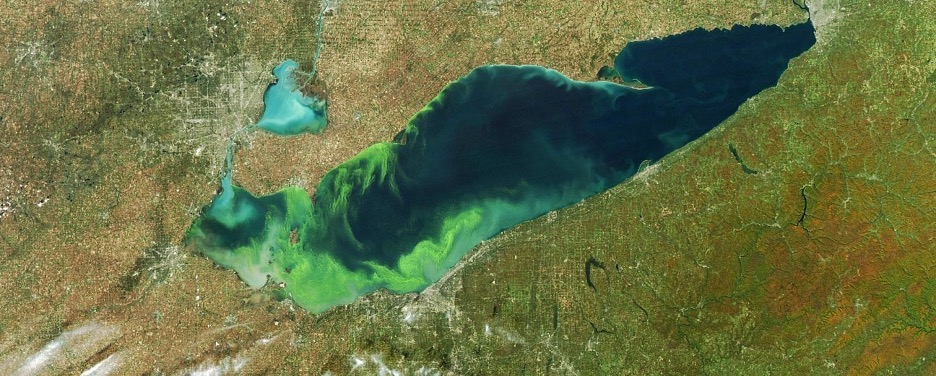
Figure 1: Satellite imagery of a 2015 Lake Erie HAB, National Oceanic and Atmospheric Association
This material link drawn between farm field nutrients, wetlands, and Lake Erie HABs is the foundation for H2Ohio’s approach to HAB mitigation, which seeks to develop a budgetary model of nutrient inputs and outputs throughout Lake Erie’s watershed and, through this, quantitatively measure the perceived costs and benefits of various nutrient pollution mitigation strategies. In my research, I have been following two groups who are responsible for creating key building blocks of such nutrient budgets: 1) agricultural professionals working to calculate the impacts various nutrient “best management practices” have on nutrient run-off from farm fields and 2) wetland ecologists who are developing a comprehensive protocol for monitoring how wetlands retain nutrients from waterways such that new and existing wetlands can be (re)constructed in ways that increase nutrient retention.
While the comprehensive budgetary model that these efforts contribute to constitutes one of the most holistic and detailed attempts to calculate nutrient distributions anywhere in the world, it does so on the condition that the phenomenon of HABs can be parsed into discrete, measurable, and exchangeable units—such as whole ecosystem mass balances of dissolved and particulate phosphorus. Indeed, I suggest that it is through such individualized units that accountability and credit for nutrient pollution mitigation is conceived.
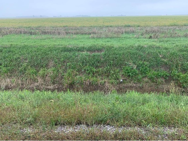
Figure 2: An irrigation drain pokes through farm fields in Lake Erie’s watershed, photo by author
Upon reflecting further on the conference speaker’s talk, I thought about the different disruptions he lumped together and how effective “the power of one” was at flattening such differences. When he spoke, it seemed reasonable, for instance, to imagine that addressing the problem of climate change might involve strategies and frameworks used within the domain of marital strife. “The power of one” urges us to conceive and confront these distinct problems with the same basic units, namely, equally empowered human actors instead of, for instance, corporations or governments.
Considering such insights in relation to my study of H2Ohio, I have come to ask in my research what material and political effects are set into motion by H2Ohio’s budgetary intervention and, crucially, what frames and scales of intervention it forecloses. In doing so, I draw from scholars of discards and environmental pollution, who have offered powerful critiques of “permission to pollute” regulatory systems (Liboiron 2016) and individualized harm-based models of environmental politics, both of which obscure structural distributions of violence across classed, gendered, and racial lines (Murphy, Shadaan 2020). Indeed, as such scholars make clear, “the power of one” is itself a technology of power. Additionally, I draw from non-scalability theorists such as Anna Tsing, who has shown how the myth of precision-nested scales, best-evinced by the pixelated zoom effect in digital imaging, is a key technology and conceptual resource through which homogenizing structural forms, such as the colonial plantation, may be extended through time and space (Tsing 2012). Thinking with such scholars has been invaluable as I follow the work of H2Ohio agriculture professionals and wetland ecologists to trace the effects and foreclosures that the budgetary frameworks they contribute to produce.
How Plants Become Bits
While many nutrient best management practices advocated for by H2Ohio agricultural professionals involve traditional low-tech interventions into nutrient pollution, such as rotating the kinds of crops planted in the soil each season, most best management practices involve a host of technologies and methods loosely referred to as precision agriculture. Broadly speaking, precision agriculture is a style of farming that leverages in situ and remote sensing technologies (primarily satellite and drone imaging), telematic networks, and data analytics to inform better decision making on farm fields, such as nutrient application rates. Through such technologies, it is argued, crop nutrient needs can be assessed more accurately via the generation of nutrient “prescriptions” and applied more efficiently via autonomous machines, which apply nutrients at customized time intervals and leaf-sized scales (Figure 3).
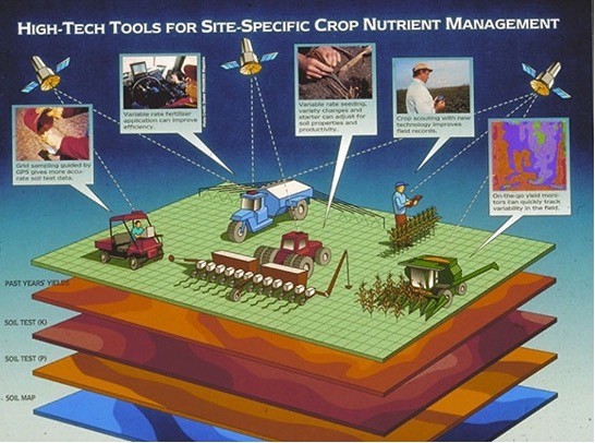
Figure 3: Precision agriculture, as imagined by the CCNetAg Group in the mid-1990s, Sonka and Coaldrake 1996
Among the various ways in which precision agriculture technologies are expected to alter farm operations, the vast swathes of data such practices generate are an emphasized component for industry leaders. To put this into perspective, one agronomic scientist at Ohio State University calculated the amount of data an average precision agriculture farm operation can expect to generate in a given growing season: .5 kB/plant (corn). Explaining this ratio in more relatable terms, he says this is “about like one acre of corn sending you 9000 email messages about how it’s doing each season.” Thus, one consequence of H2Ohio’s commitment to individualized accountability in its efforts to curb nutrient pollution is that data and data analytics are becoming foundational resources around which the business of sustainable farming is arranged. As farmers work to retain ownership and control of their field data—as it is collected via leased sensing technologies and proprietary data processing software, transferred via both private and government owned telematic networks, stored by for-profit cloud servers such as Amazon Webservices (who is currently completing the construction of its third of five planned data warehouses outside Columbus’s I-270 outer belt), and then analyzed by data firms using proprietary algorithms—new property regimes and unequal power relations within and beyond the farming industry materialize.
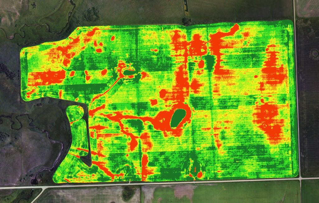
Figure 4: A “prescription map” indicating nutrient deficiencies across various crops within a farm field, ArgenTech Solutions
Similarly, in the context of wetland science, as algorithms are used to identify correlations among various types of wetland data collected by wetland ecologists, it is possible that such correlations may be used to inform the design and manufacturing of wetland ecologies in the future, thus baking into lively ecosystems both the concept of individuated nutrient retention and correlations amongst wetland attributes that humans may not fully understand. Furthermore, as the prospect of building wetland ecosystems with algorithms signals new disciplinary collaborations amongst ecologists and data specialists, the epistemic and material consequences of such collaborations remain unclear.
Black Boxes and the Legacies of H2Ohio Nutrient Budgets
While uncertainties abound surrounding the long term political and material consequences of H2Ohio’s parsing of the phenomenon of HABs into individualized units, it is important to note that the units themselves are not impervious to muddying uncertainties. “Legacy nutrients,” for instance, which, due to both anthropogenic and natural processes, accumulate in contemporary farm soils at unknown volumes and dissolve into waterways at rates varying from one year to one century, complicate H2Ohio’s tidy input-output budgetary frameworks and, notably, pose questions of accountability for HABs at temporal scales beyond contemporary regulatory frameworks. Similarly, the presence of centuries-old underground drainage tile networks, once used by white settlers to convert a vast swampland infamously referred to as the Great Black Swamp into the flat agricultural landscapes associated with the region today, introduce additional uncertainties into H2Ohio nutrient budgets by altering farm field irrigation patterns and, thus, rates of nutrient run-off (Figure 5).
Importantly, given that such drainage efforts coincided with the illegal encroachment of settlers onto Ottawa Nation territories established by the treaty of Detroit in 1807, underground drainage tile networks may be considered as much a technology of settler colonial land dispossession as they are contemporary nuisances to both nutrient pollution and H2Ohio’s efforts to curb it. In the way that both legacy nutrients and nutrients leached by underground tiles used to drain the Great Black Swamp exist outside the purview of H2Ohio’s nutrient budgets, so too do histories of settler colonial land dispossession and the related territorial logics which structure the lives of displaced Indigenous peoples today.
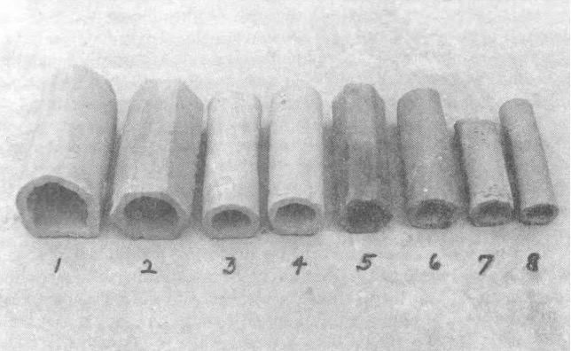
Figure 5: Clay drainage tiles used to drain the Great Black Swamp in the mid 1800s, Northwest Ohio Quarterly 1984
When inconvenient complexities such as legacy nutrients have been described to me, notably by the H2Ohio wetland team’s project lead who wrote her dissertation on the topic, the term “black box” is consistently used. Interestingly, this term, which refers to something that “can be viewed in terms of inputs and outputs without any knowledge of its internal workings,” was also used by an agricultural specialist who tried drawing for me a diagram of where a farmer can expect their data to travel once it is captured. The term also happens to be frequently associated with the perils of big data analytics and has been coined by STS scholar Bruno Latour to describe the way scientific and technical work is “made invisible by its own success” (Latour 1985). My interlocutors know better than anyone how formidable H2Ohio’s many black boxes are and, yet, this does not stop them from lighting matches in the dark. As I watch them confront the constraints of scalability and individuated accountability head on in their knowledge practices, through creative budgeting tactics, passion side projects, or the addition of innovative sampling methods, the possibility of imposing a purely technical or theoretical critique of H2Ohio’s budgetary logics quickly crumbles. Even within the tiny frames of Zoom rectangles, so much life leaks into view. Meanwhile, as I sit and document the minutiae of seemingly banal conversations about the regional politics of sensor purchasing, file-sharing incompatibilities linked to proprietary software laws, the permits needed to physically access wetland properties, or how gendered labor roles and professional credentials channel the energies of H2Ohio researchers, I fashion a partial foothold for witnessing how structures old and new animate the politics of HAB mitigation and life in Lake Erie, Ohio.
References
Latour, Bruno. 1985. Science in Action: How to Follow Scientists and Engineers Through Society. Harvard University Press.
Liboiron, Max. 2016. “Redefining pollution and action: The matter of plastics.” Journal of Material Culture, 21(1): 87-110.
Murphy, Michelle, Shadaan, Reena. 2020. “EDCs as industrial chemical and settler colonial: Towards a decolonial feminist approach.” CATALYST, 6(1).
Tsing, Anna. 2012. “On nonscalability: The living world is not amenable to precision-nested scales.” Common Knowledge, 18(3): 505-524.

1 Trackback