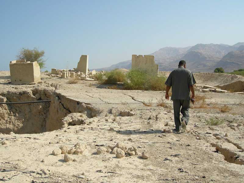
A resident of a Jordanian village near the Lisan Penninsula walks among sinkholes. Photo by author.
In a heavily air-conditioned room in the suburbs of Tel Aviv, Israeli, I spent two days drinking instant coffee and taking notes at a “transboundary” water conference on the Jordan River Watershed. Israeli, American, and Western European scholars and development consultants had come together to seek solutions for a variety of environmental crises plaguing the Jordan River and the Dead Sea, sinkholes chief among them. A single Jordanian policymaker attended, opening the event with an introductory speech, but heading immediately for the door when he finished his presentation. In the hours that followed, workshop participants argued about the trustworthiness of Palestinian water consumers (none of whom were present), the merits of international river commissions, and game theory-based water conservation strategies. One common perspective prevailed: as an American hydrologist put it, “we water people think at the level of the watershed, not the nation.” But what happens when contested national borders create barriers to the production of scientific knowledge about hydrologic and geologic phenomena? In the context of ongoing struggles for self-determination and national recognition, the Dead Sea sinkhole problem—and the different approaches to it—highlight fraught political complexities of the conflict over land in Palestine and Israel.
Sinkholes and boundaries
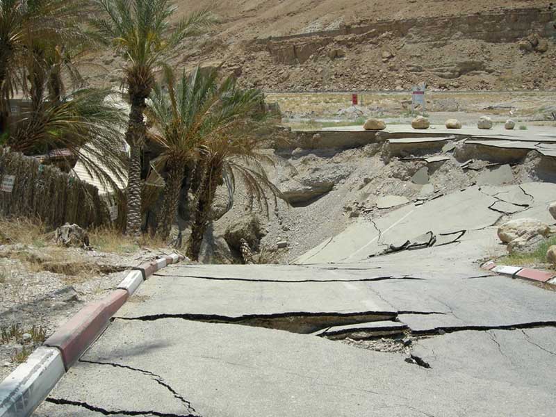
Sinkholes around the Dead Sea impact everything from commodity chains, to tourists’ travel plans, to security regimes. As the soft earth along the Dead Sea’s shores caves in, it takes concrete, asphalt, electrical wires, metal pipes, donkeys, cars, bulldozers, and people with it. Some sinkholes are as small as a toaster; others are as large as a city block. People who study the sinkhole problem in Palestine, Israel, and Jordan estimate that four to five thousand sinkholes now dot the landscape around the Dead Sea, though no one knows the number for certain.
The Dead Sea is a boundary-crossing—that is, transboundary—body of water which crosses international borders, shared by Jordanians, Palestinians, and Israelis under international law. The area around the Dead Sea is subject to military occupation, fraying diplomatic ties, and competition for scarce arable land and potable water. Everyone agrees that the sinkholes pose an existential threat to Dead Sea ecologies, industries, and communities. But anti-normalization policies, government dispossession, histories of displacement, political borders, and checkpoints, among many other things, prevent Palestinian, Israeli, and Jordanian academics from collaborating on projects as simple as an accurate count of the sinkholes.
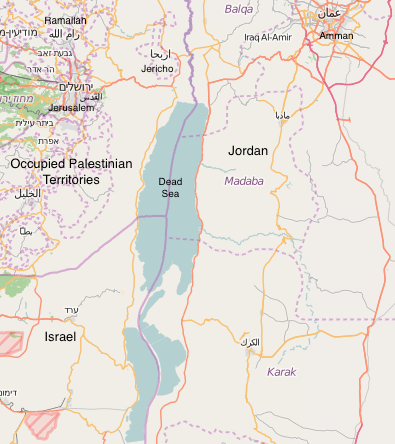
The Dead Sea and its international borders between the West Bank, Israel, and Jordan. Image courtesy of Open Street Map, © OpenStreetMap contributors, openstreetmap.org.
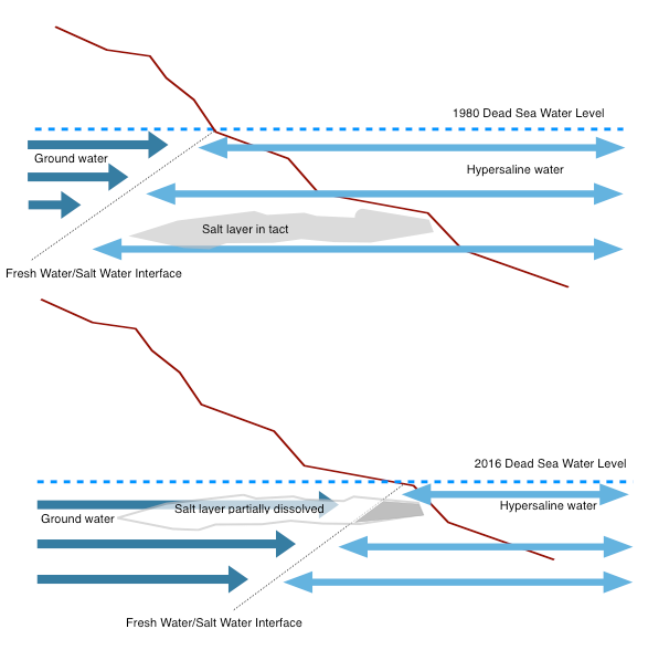
Sinkholes form when the underground freshwater-saltwater interface moves as Dead Sea water levels fall, creating subterranean vacuums as ground water dissolves a salt layer. Graphic by author.
The freshwater-saltwater interface
Sinkholes form around the Dead Sea because of a deteriorating hydrogeologic border: the “freshwater-saltwater interface,” an invisible underground boundary below shorelines, where flowing groundwater and hypersaline seawater meet. When seawater levels drop, as they have done in the Dead Sea at the rate of 1.5 meters per year, this border between waters of different salinity recedes with the falling water line.
As the freshwater-saltwater interface moves underground toward the shrinking sea (as in my illustration above), it encounters and dissolves buried pockets of salt, forming an underground vacuum. Above the vacuums that these pockets leave behind, sinkholes appear in the Earth’s surface (see Abu Karaki et al 2005; Al-Nawasra 2013; Frumkin and Raz 2000; Yechieli et al 2003). In the aqueous border zone around the Dead Sea, these enormous underground vacuums and the sinkholes they create impede the supply chains of Dead Sea chemical and cosmetics manufacturers, the production capacity of agricultural land, and state efforts to maintain important pieces of infrastructure like highways, electrical wires, and waterlines.
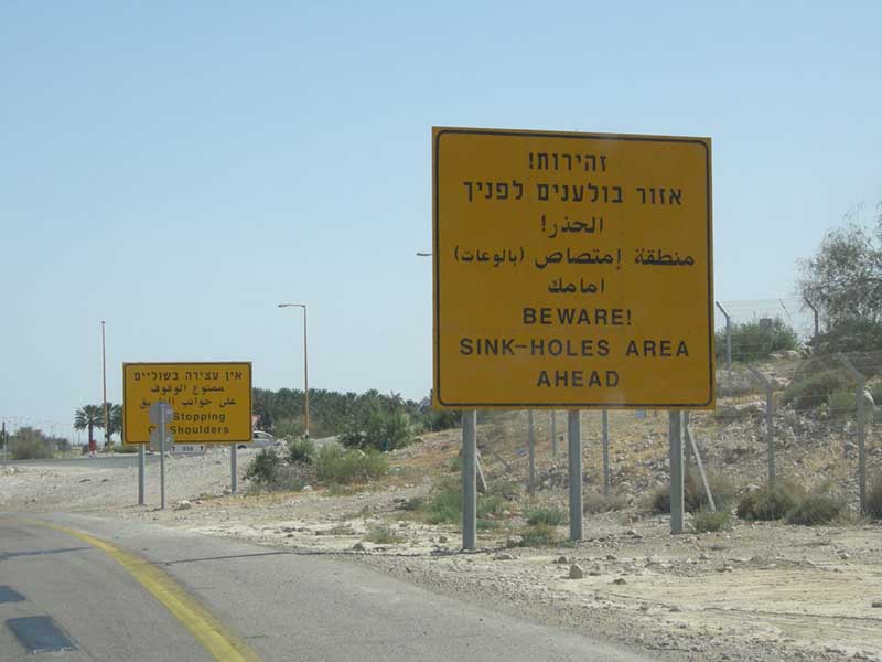
Signs on Route 90 which runs along the western edge of the Dead Sea. Photo by author.
Sinkholes, statehood, and mapping
One hot, hazy afternoon in midsummer, I was peering over a radar image of the Dead Sea gathered by an Italian Earth observation system called COSMO-SkyMed with an Israeli geologist when his phone rang. A brief conversation in Hebrew followed, concluding with him chuckling to the person on the other line, “how do you call this place…Israel, Occupied Territories, Palestine, that’s a problem for YOU. I mean, is it called the Geological Survey of Palestine?” He hung up, and turned back to me. The call was from a reporter trying to fact check a wire service article about a new sinkhole, which had opened a few days before at a beach facility operated by an Israeli settlement in the West Bank. The reporter needed to know: just where did the new sinkhole open?
In academic settings, as at the conference in the Tel Aviv suburbs, Israeli, American, and Western European hydrologists and geologists often de-emphasize the importance of bitterly contested political borders. Sinkhole scientists’ subject positions determine whether or not they can pass freely over such borders, and consequently, how they are able to construct the sinkhole problem.
A new sinkhole opened at an Israeli-settlement-run beach in the West Bank. Photo by author.
The location of this particular sinkhole is a political question, not a scientific one. It opened in a part of the West Bank in which the Israeli government maintains military and civil control, as specified by the Oslo Accords. Under the international legal framework of the Fourth Geneva Convention, this is occupied territory, but for many Israelis, the area is indistinguishable from other Israeli-operated tourist installations in the desert.
How sinkhole scientists approach this problem shows how the politics of the conflict filter into the production of technoscientific knowledge about Dead Sea sinkholes. The Israeli geologist’s answer to the reporter’s seemingly innocuous query highlighted the fact that West Bank or not, Oslo Accords or not, UNESCO recognized Palestinian statehood or not, the sinkholes at Israeli settlement facilities in the West Bank fell under the Geological Survey of Israel’s purview. In this geologist’s mind, the settlement sinkholes were an Israeli problem.
The geologist continued: “when you send papers for publication [in scientific journals], and you work in the Occupied Territories, and you don’t write on the map ‘Occupied Territories,’ you don’t put a border even. But sometimes the reviewers are more strict and they have their own political views. They may want to make us write ‘Jordan’ or ‘Palestine,’ I don’t know.” I asked what he does when he receives feedback like this, whether he makes the requested changes to the map. “Usually no,” he replied, “usually we send it to another journal.”
Sinkholes clustered along a fault line next to the Dead Sea near the 1949 Armistice Line. Photo by author.
Sinkhole prediction
The way that COSMO-SkyMed radar images are studied and analyzed at the Geological Survey of Israel indicates the political framing of Dead Sea sinkholes by the scientists who study them. It often replicates the same pattern of de-emphasizing political borders.
The radar images that the Israeli Geological Survey buys from the Italian Space Agency, operators of COSMO-SkyMed, cost about $25 per image. By comparing sets taken sixteen days apart, Israeli geologists have found that it is possible to predict the location of a future Dead Sea sinkhole. The key is to look for areas of very slight but rapid subsidence, as little as three millimeters, in the time between the two COSMO-SkyMed image sets. Field surveys are then needed to confirm the appearance of the sinkhole in the predicted place.
Epistemic links between Israeli, Jordanian, and Palestinian sinkhole scientists are unidirectional and indirect at best, severely limited by the tense political context in which they occur. In the West Bank and Israel, field surveys to confirm sinkholes predicted by the COSMO-SkyMed images are carried out by Israeli scientists living on the Israeli side of the 1949 Armistice Line, which serves as the internationally recognized border between Israeli and Palestinian territory.
Field surveys are not officially carried out by Israeli scientists in Jordan, though the Geological Survey of Israel buys and analyzes radar images of the Jordanian Dead Sea shores as well as the Palestinian and Israeli coasts. When geologists at the Geological Survey of Israel identify a possible sinkhole site in Jordan with COSMO-SkyMed radar interferometry, they note it, but do not send the information to anyone in Jordan for confirmation or use. Jordan sinkhole experts tell me that they keep current on all the work published by Israeli geologists on the matter and often cite these papers in their own publications, but the reverse is rarely true.
Security, mobility, environmental politics
Security regimes that regulate and restrict the movement of particular people in the Occupied Palestinian Territories, including around the Dead Sea, hinder watershed-scale geologic, hydrogeologic, and geomorphologic studies of the area. West Bank Dead Sea sinkholes are disconnected from Palestinian scientists at Birzeit or al-Quds Universities, while Israeli geologists in Jerusalem or Ein Gedi have easy access.
The Palestinian scientists, for whom political borders present very concrete problems for their research as well as personal safety, would frame their objects of research differently. For instance, some gathered data only on highly localized areas of subsidence in parts of the West Bank where the Palestinian Authority had (at least nominal) military and civil control. Thinking “at the level of the watershed, not the nation” as the American hydrologist in the surburbs of Tel Aviv purported to do, is a privilege accorded only to some. Systems-level framing of infrastructural and environmental crises such as Dead Sea sinkholes makes sense from a geologic perspective, but only for parties with the power to transcend restrictive border control regimes.
References
Abou Karaki, Clousson, Klinger and Hussein. 2005. Subsidence Hazards in the Dead Sea Area. Geophysics 162:221-248.
Al-Nawasra. 2013. Geomorphological Effects on the Decline of the Water Surface Level of the Dead Sea [Arabic]. Unpublished doctoral thesis. AlZaim AlAzhari University, Sudan.
Frumkin and Raz. 2001. Collapse and subsidence associated with salt karstification along the Dead Sea. Carbonates and Evaporites 16(2):117-130.
Yechieli, Wachs, Abelson, Crouvi, Shtivelman, Raz, and Baer. 2003. Formation of sinkholes along the shore of the Dead Sea: Summary of the first stage of investigation. GSI Current Research 1(13):1– 6.

2 Trackbacks